Wind Speed and Wind Direction
This worldwide wind chart can show the winds in a different region/location by holding the down the left click button of the mouse at a certain location on the map and moving the mouse so one sees the desired region. It can be zoomed/resized with the (+/-) buttons on the map or use mouse wheel to zoom in and out.
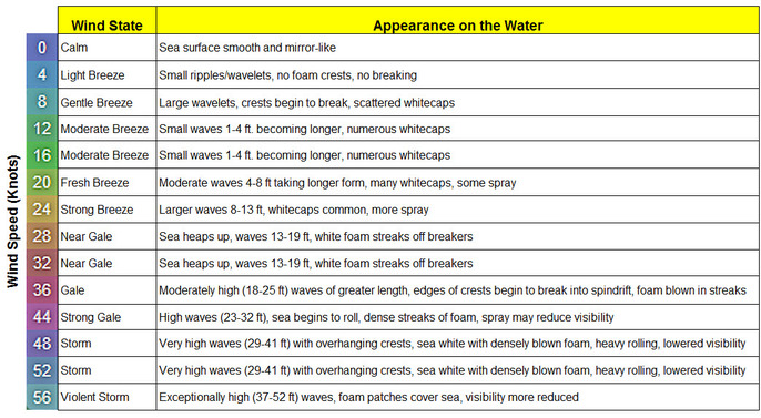
The arrow direction and flow indicates wind direction. The vertical color-coded scale on the lower right of the map indicates wind speed ranges in knots by color. Any regions on the map with red-purple-violet shades indicate gale conditions and should be avoided whenever possible by cruising yachts. The wind scale descriptions are shown below the chart.
Choose a different day from the Time drop down list to forecast the wind patterns up to four days ahead.
The GFS (Global Forecast System) forecast model, produced by NOAA, is the major source of the weather data and are updated four times a day.
.